![](/images/other/stat-length.png)
![Tour Wandern Le Mazeau - Village de La Sèvre - Photo](https://media.geolcdn.com/t/1900/400/ext.pjpeg?maxdim=2&url=https%3A%2F%2Fservices.sitytrail.com%2FGeolivesWS%2FDownloadMedia.ashx%3FTrailID%3D126835%26Media%3D20120511111934.jpeg)
Village de La Sèvre
olaze
Benutzer
![Länge](/images/other/stat-length.png)
Länge
8,7 km
![Maximale Höhe](https://static1.geolcdn.com/siteimages/upload/files/1508320355ic_sort_altitude_max_24dp.png)
Maximale Höhe
10 m
![Positive Höhendifferenz](https://static1.geolcdn.com/siteimages/upload/files/1508320355ic_sort_den_pos_24dp.png)
Positive Höhendifferenz
45 m
![Km-Effort](/images/other/stat-length.png)
Km-Effort
9,3 km
![Min. Höhe](https://static1.geolcdn.com/siteimages/upload/files/1508320355ic_sort_altitude_min_24dp.png)
Min. Höhe
0 m
![Negative Höhendifferenz](https://static1.geolcdn.com/siteimages/upload/files/1508320355ic_sort_den_neg_24dp.png)
Negative Höhendifferenz
46 m
![Boucle](https://static1.geolcdn.com/siteimages/upload/files/16400158638029165_repeat_loop_refresh_sync_direction_icon.png)
Boucle
Ja
Erstellungsdatum :
2014-12-10 00:00:00.0
Letzte Änderung :
2014-12-10 00:00:00.0
![Wandern](https://static1.geolcdn.com/sitytour/trail-icons/101.png)
2h02
Schwierigkeit : Einfach
![Scannen Sie diesen QR-Code, um die Tour in der SityTrail-Anwendung zu öffnen](https://capi.geolives.com/qq0zvz2zws4bq2lad0pu/sitytour/trails/126835/qr.png?size=200)
Kostenlosegpshiking-Anwendung
Über SityTrail
Tour Wandern von 8,7 km verfügbar auf Pays de la Loire, Vendée, Le Mazeau. Diese Tour wird von olaze vorgeschlagen.
Beschreibung
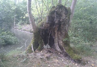
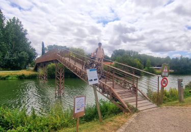
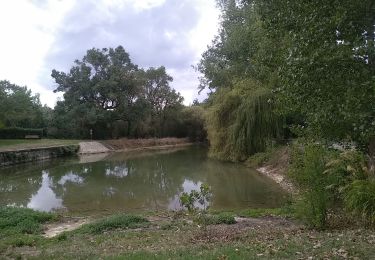
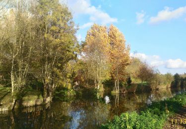
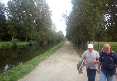
Agréable promenade dans le marais et bords de Sèvres.
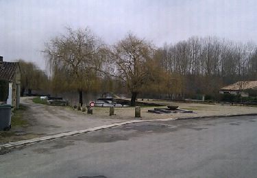
Départ et retour Le Mazeau.
Vers Le Village de Sèvre.
Club rando ATSCAF 79.
Ort
Land:
France
Region :
Pays de la Loire
Abteilung/Provinz :
Vendée
Kommune :
Le Mazeau
Standort:
Unknown
Gehen Sie:(Dec)
Gehen Sie:(UTM)
678958 ; 5133454 (30T) N.
Kommentare
Touren in der Umgebung
![Tour Wandern Arçais - Arçais - Photo](https://media.geolcdn.com/t/375/260/ext.jpg?maxdim=2&url=https%3A%2F%2Fservices.sitytrail.com%2FGeolivesWS%2FDownloadMedia.ashx%3FTrailID%3D154286%26Media%3D20120918154346.jpeg)
![Wandern Wandern](https://static1.geolcdn.com/sitytour/trail-icons/101.png)
Arçais
Wandern
Einfach
(2)
Arçais,
Neu-Aquitanien,
Deux-Sèvres,
France
![](/images/other/stat-length.png)
9,6 km | 10,2 km-effort
2h 25min
![](https://static1.geolcdn.com/siteimages/upload/files/16400158638029165_repeat_loop_refresh_sync_direction_icon.png)
Ja
![Tour Hybrid-Bike Le Mazeau - Cyclo dans le marais Poitevin - Photo](https://media.geolcdn.com/t/375/260/86905f3c-566b-4bf0-9e35-0be64feae71f.jpg&format=jpg&maxdim=2)
![Hybrid-Bike Hybrid-Bike](https://static1.geolcdn.com/sitytour/trail-icons/203.png)
Cyclo dans le marais Poitevin
Hybrid-Bike
Einfach
Le Mazeau,
Pays de la Loire,
Vendée,
France
![](/images/other/stat-length.png)
48 km | 51 km-effort
4h 10min
![](https://static1.geolcdn.com/siteimages/upload/files/16400158638029165_repeat_loop_refresh_sync_direction_icon.png)
Ja
![Tour Fahrrad Maillezais - Les Vals d'Autise Maillezais, Le Mazeau, Damvix, Maillé - Photo](https://media.geolcdn.com/t/375/260/ext.jpg?maxdim=2&url=https%3A%2F%2Fstatic1.geolcdn.com%2Fsiteimages%2Fupload%2Ffiles%2F1524743154velo.jpg)
![Fahrrad Fahrrad](https://static1.geolcdn.com/sitytour/trail-icons/200.png)
Les Vals d'Autise Maillezais, Le Mazeau, Damvix, Maillé
Fahrrad
Einfach
(1)
Maillezais,
Pays de la Loire,
Vendée,
France
![](/images/other/stat-length.png)
35 km | 37 km-effort
2h 13min
![](https://static1.geolcdn.com/siteimages/upload/files/16400158638029165_repeat_loop_refresh_sync_direction_icon.png)
Ja
![Tour Wandern Le Mazeau - Mazeau_Marais_Sauvage - Photo](https://media.geolcdn.com/t/375/260/c928f69a-d8cb-467b-bfde-89b85eb625c6.jpg&format=jpg&maxdim=2)
![Wandern Wandern](https://static1.geolcdn.com/sitytour/trail-icons/101.png)
Mazeau_Marais_Sauvage
Wandern
Einfach
Le Mazeau,
Pays de la Loire,
Vendée,
France
![](/images/other/stat-length.png)
8,6 km | 9,2 km-effort
2h 45min
![](https://static1.geolcdn.com/siteimages/upload/files/16400158638029165_repeat_loop_refresh_sync_direction_icon.png)
Ja
![Tour Wandern Benet - Les Nattes - Photo](https://media.geolcdn.com/t/375/260/a97c3037-e825-40d3-8987-e43b5676dc7d.jpg&format=jpg&maxdim=2)
![Wandern Wandern](https://static1.geolcdn.com/sitytour/trail-icons/101.png)
Les Nattes
Wandern
Einfach
Benet,
Pays de la Loire,
Vendée,
France
![](/images/other/stat-length.png)
9,8 km | 10,5 km-effort
3h 17min
![](https://static1.geolcdn.com/siteimages/upload/files/16400158638029165_repeat_loop_refresh_sync_direction_icon.png)
Ja
![Tour Wandern Coulon - Village de La Sèvre (pont Irleau)9,4km - Photo](https://media.geolcdn.com/t/375/260/fd1d97d5-7e71-4221-a960-75ca1377e151.jpg&format=jpg&maxdim=2)
![Wandern Wandern](https://static1.geolcdn.com/sitytour/trail-icons/101.png)
Village de La Sèvre (pont Irleau)9,4km
Wandern
Einfach
Coulon,
Neu-Aquitanien,
Deux-Sèvres,
France
![](/images/other/stat-length.png)
9,5 km | 10,1 km-effort
2h 15min
![](https://static1.geolcdn.com/siteimages/upload/files/16400158638029165_repeat_loop_refresh_sync_direction_icon.png)
Ja
![Tour Wandern Le Mazeau - Le Mazeau 1 - Photo](https://media.geolcdn.com/t/375/260/ext.jpg?maxdim=2&url=https%3A%2F%2Fservices.sitytrail.com%2FGeolivesWS%2FDownloadMedia.ashx%3FTrailID%3D843604%26Media%3Dfix__20171010154548.jpg)
![Wandern Wandern](https://static1.geolcdn.com/sitytour/trail-icons/101.png)
Le Mazeau 1
Wandern
Einfach
Le Mazeau,
Pays de la Loire,
Vendée,
France
![](/images/other/stat-length.png)
8,6 km | 9,3 km-effort
2h 1min
![](https://static1.geolcdn.com/siteimages/upload/files/16400158638029165_repeat_loop_refresh_sync_direction_icon.png)
Ja
![Tour Wandern Le Vanneau-Irleau - Le Vanneau circuit sec - Photo](https://media.geolcdn.com/t/375/260/ext.jpg?maxdim=2&url=https%3A%2F%2Fservices.sitytrail.com%2FGeolivesWS%2FDownloadMedia.ashx%3FTrailID%3D201299%26Media%3D20130212154447.jpeg)
![Wandern Wandern](https://static1.geolcdn.com/sitytour/trail-icons/101.png)
Le Vanneau circuit sec
Wandern
Einfach
Le Vanneau-Irleau,
Neu-Aquitanien,
Deux-Sèvres,
France
![](/images/other/stat-length.png)
7,4 km | 7,9 km-effort
1h 53min
![](https://static1.geolcdn.com/siteimages/upload/files/16400158638029165_repeat_loop_refresh_sync_direction_icon.png)
Ja
![Tour Wandern Le Vanneau-Irleau - Le Vanneau circuit sec - Photo](https://media.geolcdn.com/t/375/260/ext.jpg?maxdim=2&url=https%3A%2F%2Fservices.sitytrail.com%2FGeolivesWS%2FDownloadMedia.ashx%3FTrailID%3D174924%26Media%3D20130212154447.jpeg)
![Wandern Wandern](https://static1.geolcdn.com/sitytour/trail-icons/101.png)
Le Vanneau circuit sec
Wandern
Einfach
Le Vanneau-Irleau,
Neu-Aquitanien,
Deux-Sèvres,
France
![](/images/other/stat-length.png)
7,4 km | 7,9 km-effort
1h 45min
![](https://static1.geolcdn.com/siteimages/upload/files/16400158638029165_repeat_loop_refresh_sync_direction_icon.png)
Ja